The Ribble Valley Jubilee Trail
The Route
The Ribble Valley Jubilee Trail can be walked in clockwise or anti-clockwise directions, but this overview reflects the way-marking on the ground, which describes the route taking an anti-clockwise circuit.
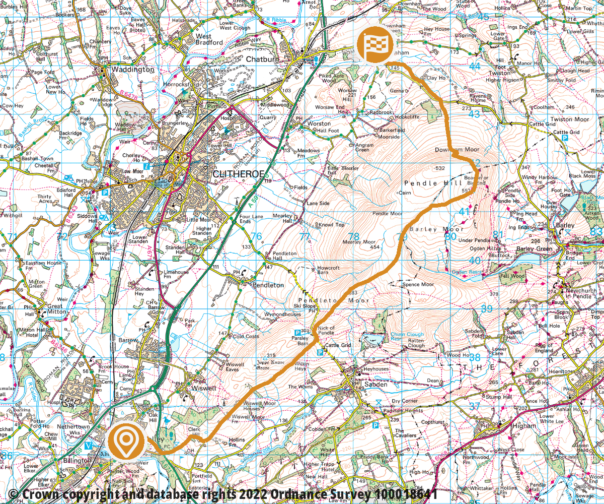
Section 1: Whalley to Downham | 8.9 miles | Demanding
This first stage is a relatively short route, but it does take in the challenge of the ascent to the summit of Pendle Hill, which although lying just outside the Borough boundary, is a glorious viewpoint which could not be excluded.
From Whalley town centre, the route rises to Spring Wood, skirts the golf course and then joins the old drovers’ track to the Nick of Pendle and thereafter the well-trodden path to the summit.
From there, the steep descent to Downham is rewarded by the timeless beauty of this picture postcard village nestling below the steep slopes of Pendle.
Link to relevant section in: OutdoorActive | OS Maps
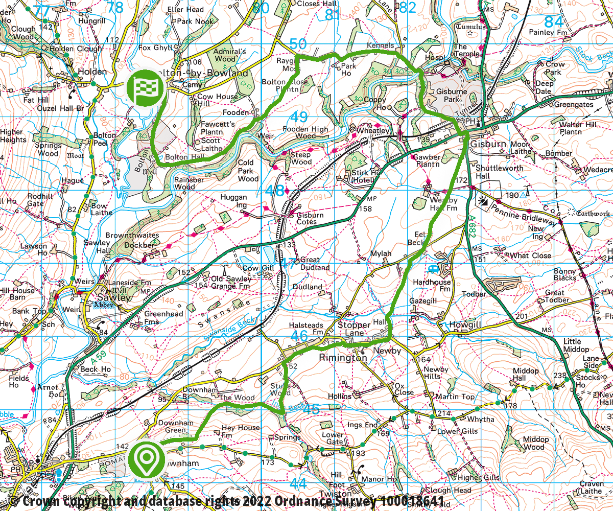
Section 2: Downham to Bolton by Bowland | 9.4 miles | Moderate
This is a similar distance to the first section, but much less demanding as it tracks over farmland to the village of Rimington. From there, a direct route takes us to Gisburn which is on the main A59 and offers many facilities.
From Gisburn there is a length of road walking on a quiet, well-maintained country lane. Leaving the road, we then track across to join the River Ribble and onwards to Bolton Hall, finally arriving in the historic village of Bolton by Bowland.
Link to relevant section in: OutdoorActive | OS Maps
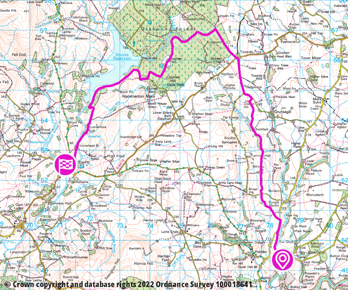
Section 3: Bolton by Bowland to Slaidburn | 11.2 miles | Demanding
Leaving Bolton by Bowland on the first of the two longer sections, we head north across rolling fields to reach the hamlet of Tosside on the border with North Yorkshire, offering splendid views of the Yorkshire Three Peaks.
From here we join the woodland tracks of Gisburn Forest, turning west past the Visitor Centre and café to arrive at the impressive expanse of Stocks Reservoir – built in the 1930’s to service Preston – before descending to the picturesque village of Slaidburn.
Link to relevant section in: OutdoorActive | OS Maps
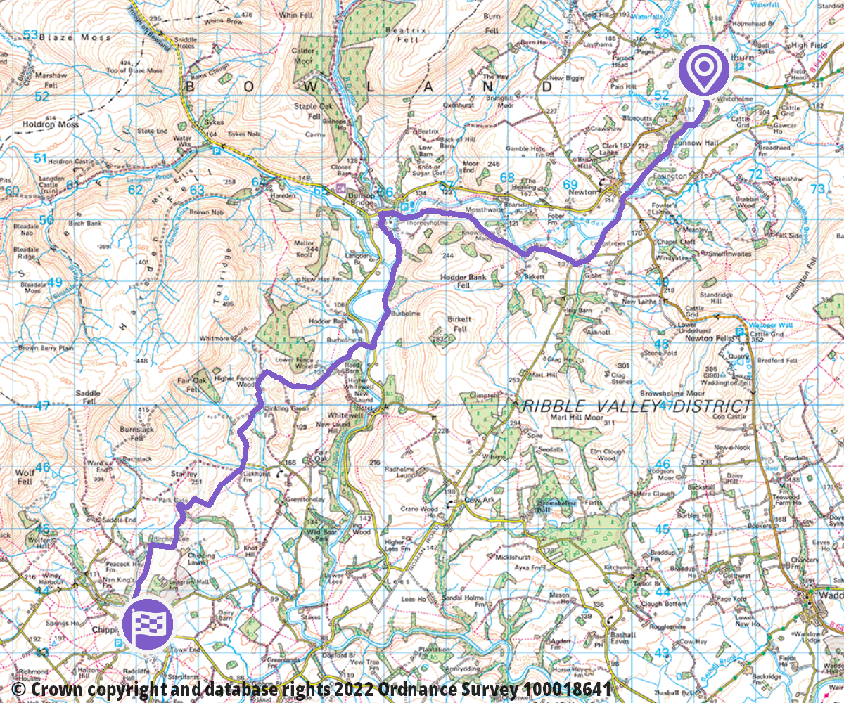
Section 4: Slaidburn to Chipping | 11.5 miles | Demanding
The next section is probably the most spectacular in many ways, as it follows the beautiful valley of the River Hodder. It’s another longish day of 11.2 miles – but with more ascent than the previous section.
Initially we follow the river to the village of Newton and then across fields to join a bridleway taking us past the Victorian splendour of Knowlmere Manor to Dunsop Bridge – famous as the geographical centre of the United Kingdom.
From Dunsop Bridge, we again follow the Hodder, leaving it at Burholme Bridge to ascend amid splendid views of the Bowland Fells before walking among the foothills of the higher fells then descending to the thriving village of Chipping – famous for its annual Stream Fair and Agricultural Show.
Link to relevant section in: OutdoorActive | OS Maps
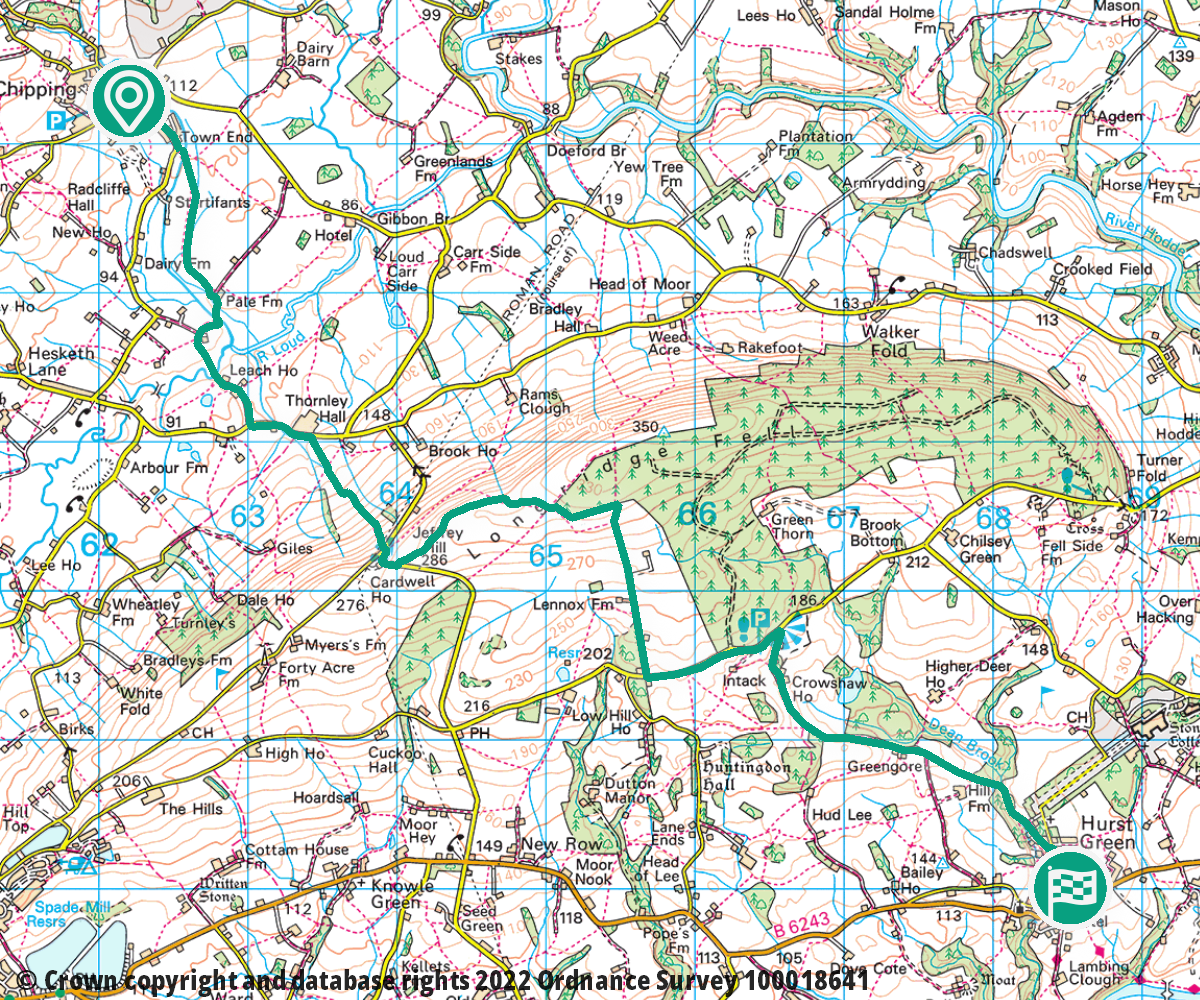
Section 5: Chipping to Hurst Green | 7.1 miles | Demanding
This may be a relatively short section with a deceptively gentle start across rolling farmland, but it soon ramps up on the ascent of Jeffrey Hill which – although steep – offers excellent views back across the Hodder Valley.
We skirt around the edges of Longridge Fell to follow an attractive and easy descent to Hurst Green, which there are numerous refreshment options and the option of a detour to admire the spectacular façade of internationally renowned public school of Stonyhurst College, where Lord of the Rings author JRR Tolkien wrote part of his Lord of the Rings Trilogy.
Link to relevant section in: OutdoorActive | OS Maps
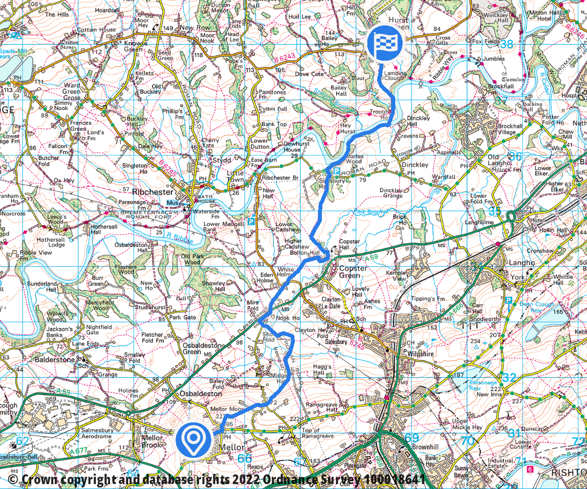
Section 6: Hurst Green to Mellor | 6.7 miles | Moderate
Leaving Hurst Green, the route descends to join the Ribble again for a short way before climbing slowly to the hamlet of Copster Green. From there we cross the A59 to climb gently to the village of Mellor with an interesting disused Royal Observer Corps bunker and admire splendid views to match those of Pendle Hill across an expanse of the North of England from the summit on Mellor Moor.
Link to relevant section in: OutdoorActive | OS Maps
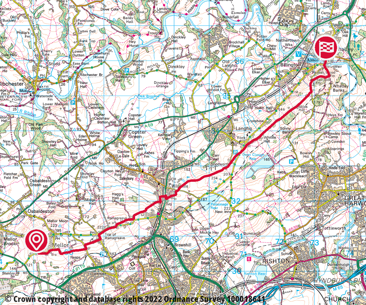
Section 7: Mellor to Whalley | 7.7 miles | Moderate
In the final section from Mellor, the route returns north-east to follow the Borough boundary with neighbouring Blackburn, descending to the community of Wilpshire. A short but steep ascent takes us across the local golf course to Wilpshire Moor and splendid views of Pendle Hill as we start to approach Whalley from the return side.
Some road walking on a quiet country lane brings us to a steep but very picturesque final descent to our starting point in Whalley and the completion of the Jubilee Round!
Link to relevant section in: OutdoorActive | OS Maps